Note: fig nos in brackets refer to CAMUS BOOK CHAPTER 15
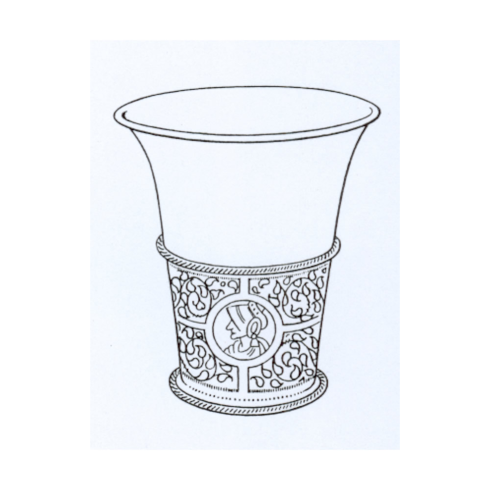
Fig A1 (Fig 15g) Chalice Beaker, dated 1610-1620, possibly of German or Netherlands origin with three medallions of profile heads. (drawing NADFAS)
Fig A2 (Fig 15n) Sundial; intricately carved sundial in the field South of the church dating from the time of Charles I. (as published by Bridges 1791)

Fig A3 (Fig 14o) Map of Upton 1584, drawn by Toby Houghton. North is to the right of the map. Note the dovecot (‘dufcot’) at the top and the windmill on the left. ‘Chapel Wode’ is now called Upton Wood, but its dimensions and boundaries have not changed over420 years (compare with the 1:50000 map). ‘Heyes Wode’ is now called Hayeswood Spinney. The track running from left to right (North-South) in front of ‘Chapel Wode’ and’ Heyes Wode’ is now called Barn Road, but was known then as ‘Sowthe Lane’. The Roman road, King’s Street or the Long Ditch (Langdyke) runs along the bottom (Eastern) edge of ‘Cockeshoot Closse’, ‘Fur Clos’ and ‘Heyes Closse’. Note the names of the pre-enclosure Open Fields.