The Ground Plan of a Roman Building, under the lane and adjacent hill, north of the church
Ref No
Plate 11
Subject
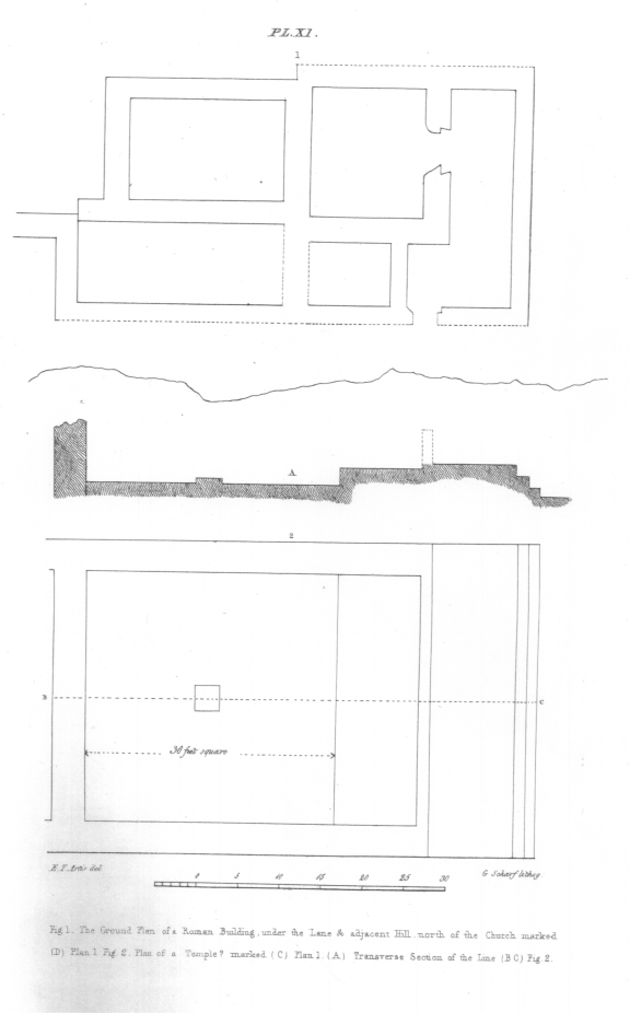
Fig. 1 The Ground Plan of a Roman Building, under the lane and adjacent hill, north of the church, marked D, Plan 1. Fig. 2. Plan of a Temple, marked C, Plan 1. (A). Transverse section of the line (B C), fig. 2.
Detail
Document
The Durobrivae of Antonius identified and illustrated in a series of plates