![Fig G1 ROMAN FOUND CH Hill sml](http://www.sallyleeds.co.uk/clients/castorchurch_may2022/wp-content/uploads/2014/10/Fig-G1-ROMAN-FOUND-CH-Hill-sml-150x150.jpg)
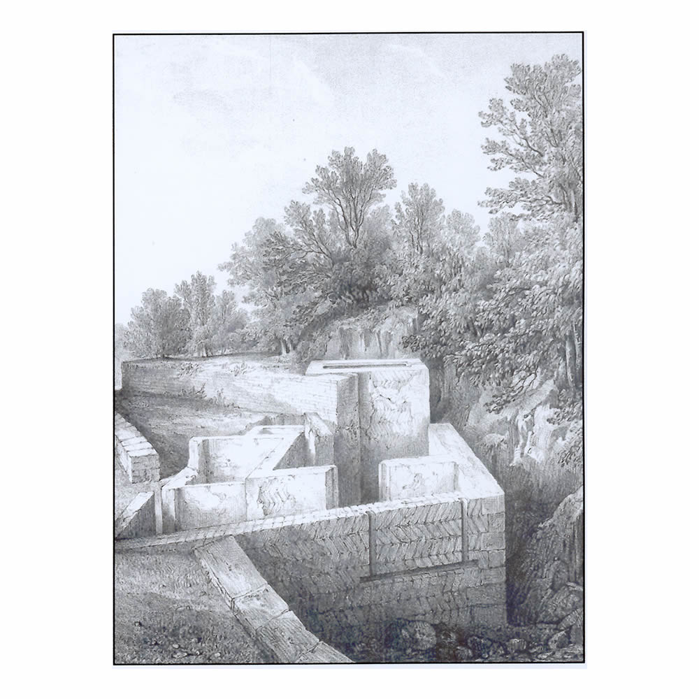
Fig G1. Roman foundations on Church Hill excavated and drawn by Edmund Artis AD 1828
![Fig G2 Roman Palace sml](http://www.sallyleeds.co.uk/clients/castorchurch_may2022/wp-content/uploads/2014/10/Fig-G2-Roman-Palace-sml-150x150.jpg)
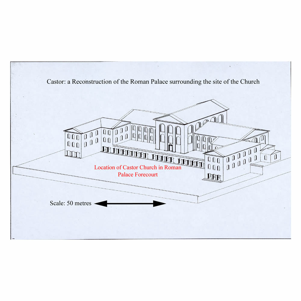
Fig G2. Drawing of reconstruction of Roman Palace in Castor Churchyard and environs.
![Fig G3 Roman Bath Artis sml](http://www.sallyleeds.co.uk/clients/castorchurch_may2022/wp-content/uploads/2014/10/Fig-G3-Roman-Bath-Artis-sml-150x150.jpg)
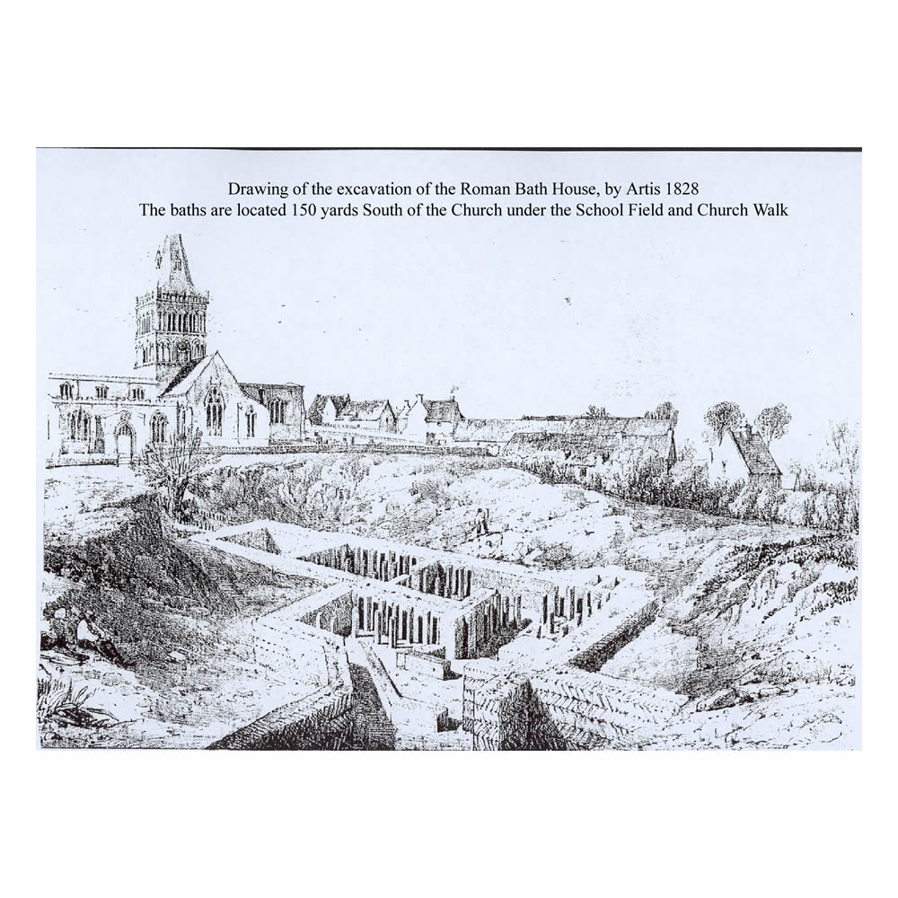
Fig G3. Roman bath foundations under Church Walk excavated and drawn by Edmund Artis AD 1828.
![Fig G4 ROMAN AREA MAP REV 2 sml](http://www.sallyleeds.co.uk/clients/castorchurch_may2022/wp-content/uploads/2014/10/Fig-G4-ROMAN-AREA-MAP-REV-2-sml-150x150.jpg)
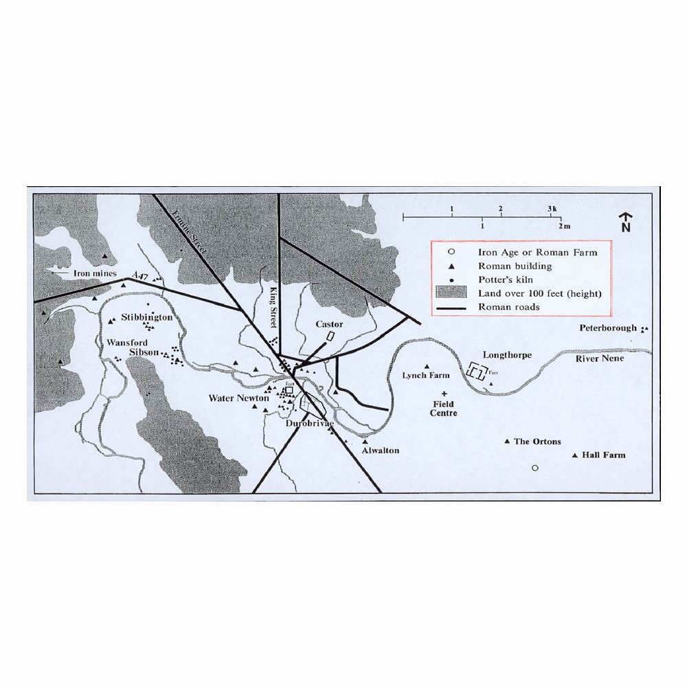
Fig G4. Map of Castor and surrounding area in Roman period.
![Fig G5 Roman Stones sml](http://www.sallyleeds.co.uk/clients/castorchurch_may2022/wp-content/uploads/2014/10/Fig-G5-Roman-Stones-sml-150x150.jpg)
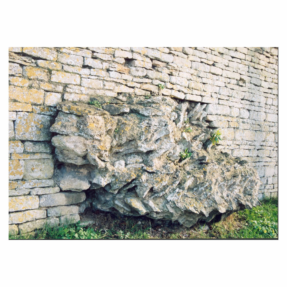
Fig G5. Roman foundations on the east side of Stocks Hill protruding from under the Old Rectory garden wall.
![Fig G6 SAXON CROSS OUTSIDE 1930s sml](http://www.sallyleeds.co.uk/clients/castorchurch_may2022/wp-content/uploads/2014/10/Fig-G6-SAXON-CROSS-OUTSIDE-1930s-sml-150x150.jpg)
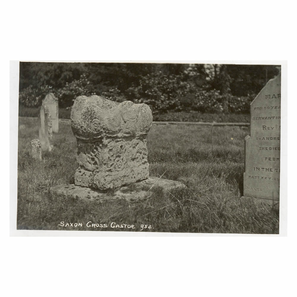
Fig G6. Castor Church – Photo of Roman pagan altar converted by Saxons into a socket for a Saxon churchyard cross.
![Fig G7 ROMAN PAL AND CHURCH DIAG sml](http://www.sallyleeds.co.uk/clients/castorchurch_may2022/wp-content/uploads/2014/10/Fig-G7-ROMAN-PAL-AND-CHURCH-DIAG-sml-150x150.jpg)
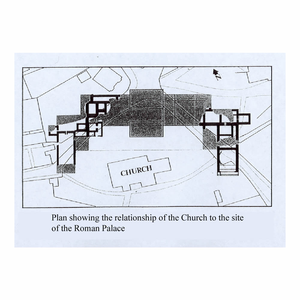
Fig G7. Castor Church – Roman Palace ground plan in relation to Castor Church.